
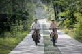
The best e-bike routes around Antwerp (20–60 km)
Are you looking for a good e-bike route around Antwerp, but all you find is either an urban loop with too many traffic lights or a GPX route that's more exhausting than relaxing? It doesn't have to be that way. I suggest four types of routes around Antwerp that almost always work: the water ribbon, the cycle highway, the belt of forts, or the Campine/heathland. And let's be honest: I have a preference for slightly longer and greener routes. Curious to find out more? Read on.
Written by: Jos Mans | February 9, 2026 | Reading time: 6minutes

About the author: Jos Mans
Jos is a writer and cyclist, most often both at the same time. With thousands of miles under his belt and just as many words on paper, he combines his two great passions: being on the move and telling stories.
Key findings
- Antwerp is actually a city of "ribbons" that is ideal for e-bikes: along the Scheldt and the Rupel, via the F-roads along the railway, and through green spaces around the forts, you can travel for miles in surprisingly beautiful surroundings.
- The main pitfall for e-bikes here is not the gradient, but the "free" speed: on bike paths, you ride faster without realizing it → higher assistance → the battery life drops faster than expected.
- The most beautiful outings are often between 45 and 60 km. Take a look at the forts or a loop in the Campines.
Where can I find my route information (and how to use it)?
- Bicycle node networks and planners – Perfect for building safe and logical connections. Easy to shorten or lengthen: this is your backbone.
- Bike paths (F-routes): Ideal if you're looking for rhythm: continuous, predictable, little stress at intersections. But, and this is where it sometimes gets tricky, this is precisely where you need to watch your speed on an e-bike.
- Themed routes – For example, around forts. These are often the easiest to follow, as the narrative and signage are generally consistent.
Four types of itineraries that almost always work
1. Scheldt & Rupel: the ribbon of water, an outing that flows naturally
2. Cycle highways: fast, hassle-free riding for miles on end
3. Belt of forts (Brialmont): the city is close by, but surrounded by greenery
4. Les Campines / the moorland: heading for nature
Routes by distance: 20, 30, 40, and 50–60 km
20–25 km: between the city and Rupel (dikes + river atmosphere)
- Departure: south of the city (Hoboken/Hemiksem) or quays of the Scheldt
- Direction: south, Escaut/Rupel atmosphere
- Surface: mainly asphalt; towpaths or dykes sometimes rougher
- Crowds: generally acceptable; busier on weekends
- Why it's e-bike-proof: you quickly leave the urban area behind, with no complicated intersections.
40–45 km: the Brialmont fort belt (green ring around the city)
- Departure: wherever you want; we'll get there quickly
- Direction: green belt around Antwerp
- Surface: mixed, but often suitable for cycling and relatively quiet
- Crowds: variable; some areas around the forts are busier than others
- Why it's e-bike-proof: variety of terrain and ideal distance for an e-bike
50–60 km: F14 towards Kapellen/Kalmthout (nature)
- Departure: Antwerp North (towards Ekeren)
- Direction: north, Ekeren – Kapellen – Kalmthout – Essen axis
- Coating: fluid, designed for rolling
- Traffic: commuter traffic at times
- Why it's e-bike-proof: long straights, little stress at intersections